Feel the Burn : City Bakes as June Gloom Gives Way to Triple-Digit Temperatures
- Share via
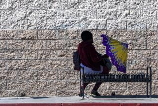
Temperatures soared to more than 100 degrees in several Southland communities Wednesday--about 20 degrees higher than normal--and forecasters said it may be even hotter today.
The fortunate among us--those who didn’t have to go to work Wednesday--could take refuge at Southern California’s beaches, where many lifeguard station thermometers topped out in the 70s. The surf was gentle and the water temperatures from Hermosa south were a relatively comfortable 68 to 73 degrees.
For the rest of us, it was just plain hot--93 in downtown Los Angeles, 98 in Burbank, 97 in Pasadena, 101 in Woodland Hills and 102 in Monrovia. In San Diego, it was a practically balmy 86, but that still broke the old record for the date--84--set in 1880.
No temperature records were broken in the San Fernando and Santa Clarita valleys, according to National Weather Service officials. In addition to the areas mentioned above, Northridge and Newhall reached 100 and Van Nuys topped out at 99.
Today’s Civic Center high is expected to be about 95 degrees, with top readings throughout the Southland generally a couple of degrees higher than Wednesday’s.
The villains in this story--if you’re one of those wimps who prefers the dank, overcast “June gloom” more typical at this time of year--are a pair of high-pressure systems that are heating things up and blocking most of the usual onshore flow of cool, moist air from the Pacific.
This high pressure will begin to break down Friday, which means the weekend won’t be quite so hot, but it should still be warmer than usual.
Mail carrier Leon Ramirez dutifully trudged his six-mile route along Ventura Boulevard in Studio City on Wednesday, dressed in shorts, a broad-rimmed hat and bug-eyed sunglasses. His only concession to the heat, he said, was that he walked a little slower.
“I just relax and try not to push myself,” he said. “If you go too fast, you’ll burn yourself out.”
His mail truck provides no respite, Ramirez said. The vehicle has no air conditioner--”just this little fan blowing hot air”--and he has to leave his “rolling oven” locked up tight whenever he parks it, which makes it even hotter.
But sympathetic residents and shopkeepers offered gifts that provided some relief.
“I’ve got three cans of soda in my bag,” he said. “Everybody is worried about me.”
In Reseda, Ben Lozano, 39, stood at his vegetable stand in a treeless lot on the corner of Victory and Balboa boulevards Wednesday afternoon, wiping his brow. Behind the stand was Lozano’s only refuge from the sweltering sun, a portable freezer.
“I could stay in there all day,” Lozano said. “Every time a customer wants fresh produce, I offer to go in there and get it.”
But the heat did not deter Reseda resident Joe Graham, 75, who was at the Van Nuys Golf Course for a few swings Wednesday afternoon. A cap and some extra sun block on his ears was all he needed to brave the heat.
“I didn’t feel too bad . . . but I didn’t shoot that well,” he said. “I don’t blame it on the heat. I blame it on my swing.”
The heat caused an upsurge in the use of electrical power, and overloads temporarily shut down transformers in scattered areas of the city, disrupting electrical service to about 100 customers. Most of the power was back on within an hour, according to Karen Shepard-Grimes, a spokeswoman for the Department of Water and Power.
Wes Etheredge, a meteorologist with WeatherData Inc., which provides forecasts for The Times, said the current heat wave is the product of a surface high-pressure system parked just off the California coast and a high-altitude ridge of high pressure centered over the western United States.
He said air circulating clockwise around the surface system is creating gentle offshore winds that are canceling the normal evening onshore flow of marine air. The upper-level ridge is pressing down on Southern California, heating the air here by compression.
The result has been a lot of thermometer readings in the upper 90s and low 100s, with temperatures a couple of degrees higher expected in many communities today. Wednesday’s highs included 103 in Hemet, 107 in Palm Springs and 108 in Thermal.
Etheredge said an upper-level storm system moving in from the Pacific Northwest will collide with the high pressure systems on Friday afternoon, breaking them down and returning Southern California to its typical May-June weather pattern.
“That means morning low clouds and fog, especially along the coast, on Saturday and Sunday,” Etheredge said. “The normal June gloom.”
Skies will clear in most areas by midafternoon Saturday and Sunday, with high temperatures at the Los Angeles Civic Center in the mid-80s--still 8 to 10 degrees above normal for this time of year. Rebuilding high pressure could cause temperatures to rise again next week.
More to Read
Sign up for Essential California
The most important California stories and recommendations in your inbox every morning.
You may occasionally receive promotional content from the Los Angeles Times.


