Walk Up to the Crater in ‘Black-Cinder’ Land
- Share via
Amboy Crater, located out in the East Mojave Desert with the old-time diners and abandoned gas stations along historic old Route 66, has been a curiosity for generations of desert travelers.
This little volcano, long extinct, can be reached with a short hike, an ideal leg-stretcher for motorists desiring a break from interminable Interstate 40.
Getting to the volcano’s trail head via Route 66 can be thoroughly enjoyable. The stretch of Route 66 from just outside Barstow to just west of Needles is the longest stretch of the historic route in California.
About 28 miles east of Ludlow, you’ll notice extensive Hawaiian-like lava fields. Amboy Crater, the cause of this flow, lies just south of the road. Some writers have been repelled, not attracted, by this scene. In “The Grapes of Wrath,” John Steinbeck wrote: “And 66 goes on over the terrible desert, where the distance shimmers and the black cinder mountains hang unbearably in the distance.”
Many of the black cinder mountains (and red ones too) are now part of the Mojave National Preserve, one of the newest additions to our national parks system.
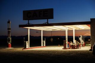
The town of Amboy, a few miles east of the crater, has never consisted of much more than a cafe or two and a motel. Built in the mid-’40s, the stop was a popular one with motorists during the Route 66 heyday. Gas is still available here.
About 2.5 miles east of town, Kelbaker Road extends north to the heart of Mojave National Preserve. The volcanically inclined visitor can count a dozen or two cones and a number of lava flows on the drive to Kelso and the heart of the preserve.
Between Amboy and Essex, you’ll notice abandoned autos, closed-down diners and service stations. The buildings may still stand, but the spirit and life behind them appears just to have dried up and blown away--exactly what happened when Route 66 was bypassed by Interstate 40.
Amboy Crater and environs are covered with two kinds of lava. The aa (pronounced ah-ah) kind consists of sharp, hiking-boot-assaulting hunks of basalt; pahoehoe (pa-HOY-hoy) is smoother, rope-like lava.
While it’s difficult to get lost because Route 66 and Amboy Crater are almost always in view, it is possible to get quite frustrated if you get sidetracked in the lava field labyrinth and end up involuntarily extending your short hike to the volcano. It’s only a little more than a mile from the parking area to the crater, but it can seem much longer if you do a lot of zigzagging over the lava. Forget trying to follow any one path and instead make a beeline for the base of the crater. Look back occasionally to establish landmarks to assist you on your return trip.
Directions to the trail head: From Barstow, head east on Interstate 40 about 52 miles and take the Ludlow exit. Join National Trails Highway (the modern name for Route 66) and drive 28 miles southeast to just short of Amboy and the intersection with Amboy Road. Turn south on an unsigned dirt road leading 0.4 mile down a short graded road. Proceed slowly on this road (littered with sharp, potentially tire-shredding lava chunks) to a dirt parking area.
The hikes from the parking area follow the vehicle road, which soon ends in a spaghetti-tangle of trails. Eyeball the crater and simply start walking straight toward it. The easiest traveling is over the smooth sandy stretches between the rough lava flows. Approaching the cinder cone, angle right toward Amboy’s west ridge. A footpath climbs to a wide opening in the crater rim. Climb into this breach in the cone, then continue on this west side to the rim for the view of the surrounding lava landscape and the East Mojave Desert.
(BEGIN TEXT OF INFOBOX / INFOGRAPHIC)
Amboy Crater Trail
WHERE: Off I-40, south of the boundary of Mojave National Preserve.
DISTANCE: 3 miles round trip with 200 foot elevation gain.
TERRAIN: Small volcano, lava field.
HIGHLIGHTS: Climb into crater: get your kicks on old Route 66.
DEGREE OF DIFFICULTY: Moderate
FOR MORE INFORMATION: U.S. Bureau of Land Management, California Desert Information Center, 831 Barstow Road, Barstow, CA 92311
More to Read
Sign up for The Wild
We’ll help you find the best places to hike, bike and run, as well as the perfect silent spots for meditation and yoga.
You may occasionally receive promotional content from the Los Angeles Times.


